УГРНРИЗЮ
 ЕПЙЎШИ АГПф
 УбЕПЙЎШИ
  РќУМКИБт


|
|
 220pxchantry_sign.jpg

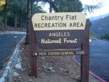 Chantry Flat is a designated "Recreation Area" within the Angeles National Forest, about three miles (5 km) into Big Santa Anita Canyon, and is closely associated with the towns of Arcadia and Sierra Madre, CA. The flat itself houses a large public picnic area, and is the starting point for several historic trails of the San Gabriel Mountains, including the 28.5-mile (45.9 km) Gabrielino Trail. The US Forest Service estimates the road to Chantry as the third busiest entry into the Angeles, next to CA State Highways 2 and 39 [1]. Historical significance Chantry Flat is home to the last pack station in Southern California. It is also the trailhead to Sturtevant's Camp, the oldest resort in the San Gabriels and one of a handful that still exist. The Chantry Flat/Big Santa Anita Canyon area boasts the last magneto-type crank phone system in the United States. The entire watershed is a living museum to the "Great Hiking Era". The Picnic Area The picnic grounds of Chantry Flat, known to locals as The Picnic Grove, are authorized for day use only. Full renovation was completed in August 2006. The site offers 35 tables, each with a charcoal BBQ; most are wheelchair accessible. Water spigots are installed throughout, and there are two flush toilet restrooms. Pack station Adams' Pack Station is a permitted outfitter and general store that has operated at Chantry Flat since 1936. One can purchase a Forest Adventure Pass there, and they also offer food and other gear as well as additional parking for visitors. The Pack Station General Store is open to the public on weekends and holidays until 5:00 PM. Parking fee The road to Chantry Flat is open daily from 6:00AM to 8:00PM. Car parking at Chantry Flats, and many places in the Angeles National Forest, are required to have a National Forest Adventure Pass. National Forest Adventure Pass may be obtained online or from Forest visitor centers and local sporting good merchants. Currently it is $5.00 a day or an a yearly pass $30. The Parking lot fills quickly in the morning on the weekends. Driving Directions From the Foothill Freeway (I-210) take the Santa Anita Avenue exit north. Follow Santa Anita Ave. through the residential neighborhood until it ends at the foot of the mountains. Pass the yellow pipe gate and continue 3 miles (4.8 km) into the mountains to the end of Santa Anita Canyon Road. |


| 
|